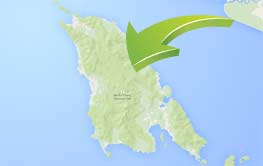
Location and accessibility
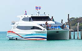
In the Eastern Gulf of Thailand, and close to the Cambodian border, Koh Chang (Elephant Island) is the largest island in the Gulf. In fact, if you discount Phuket, which is linked to the mainland by a road bridge, it is the largest island of Thailand. Only 10 kilometers from the mainland in the province of Trat, it is linked by 2 regular car ferry services.
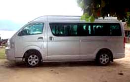
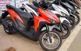
The ferry piers being just 310 kilometers from Bangkok make Koh Chang easily accessible by road from Thailand's capital and its' international airport. With a morning arrival at the aiport, it is easily possible to get to your Koh Chang resort the same day. Trat province has a domestic airport, and there are 2 - 4 flights per day to and from Bangkok. More about getting here..
Geography
Located 12 degrees north in latitude, 102 degrees east in longitude, Koh Chang is a mountainous island, with the mountain peak of Khao Salakphet being 744 meters above sea level. The island itself is about 30 km long and 13 km wide, and has an area of around 217 square kilometers. The Koh Chang marine park, constituting more than 50 other islands has a total area of around 700 square kilometers. The shape of the mountains of Koh Chang resemble elephants, and this is one reason for the name Chang (meaning elephant). The central ridge on the island runs parallel to the mainland coast, so approaching by sea, you can imagine many elephants walking in convoy. The mountain sides are quite inaccessible in most parts (due to the thick vegetation, rather than the mountain shape which is quite smooth rather than jagged and shear) and they are covered with thick, evergreen vegetation, referred to as "tropical rain forest" on most websites. Closer to the sea the vegetation is primarily coconut trees lying on the scrub land that usually runs to the sea via pale sand on the West coast, or a darker brown sand on the East coast. Many rivers flow down to the sea from the mountains. These will be full-flowing in the rainy season, but dry at the end of the dry season. Waterfalls can be found all over the island, a few hundred meters into the interior. Klong Plu Waterfall in the West, Than Mayom in the North, and Khiri Phet in the East are all worth seeing, or maybe just one will satisfy your aqua-rush-lust!
Climate
Like in Thailand as a whole, there are loosely 3 seasons in Koh Chang.
The South West monsoon season starts in May and lasts until the end of September. This region of Thailand is statistically the wettest in the kingdom, and these are the months in which 95% of Koh Chang's rain falls. That said, there is a suggestion of micro-climates, even in different parts of Koh Chang. For example, it can be raining all day in Klong Prao, but dry all day in Whitesands.  Whilst the rainfall figures can be impressive (10 cm of rain in a day as an example), during even the middle of the monsoon period, there are days with no rain, even whole weeks. If you are here for 7 days, it is almost inconceivable that all of your daylight hours would be blighted by rain. My personal experience is that May, August and September have seen many days of dry and sunny weather in the last 4 years, with most of the rain falling in June. Do yourself a favour, take advantage of the cheap room rates, and cheap flights, and come to Koh Chang for a week in August.
The Dry season starts in October and runs through to the end of February. The beginning of this period is quite windy, cool, and pleasant. By mid December the winds have gone and the temperatures are higher. January and February are probably the best months to be in Koh Chang if you want beach and sea activities.
Thailand's summer season lasts through March and April. These are the hottest months of the year in Koh Chang, and the air becomes more humid in the lead up to the Monsoon season once again.
More climate info here. For a Koh Chang weather forecast, please look here. For Koh Chang weather images going back to 2007, please look here.
Natural History
Covering the mountain range is dense and unspoiled lush and green vegetation. Some interior areas have remained untouched for 100's of years, as only recently have people ventured into the interior. Coconut plantations and fruit orchards are found around the coastal areas, and in some of the low lying valleys such as Klong Son. Mangrove forests surround the river outlets at Salak-Kok and at Klong Prao.
 Animals to be found in the island include boars, deers, langurs, other monkeys, small civets, many snakes including lethal cobras and large pythons. Recently an 8 meter specimen was found in the Klong Plu valley, close to the elephant camp. The sound of frogs on a wet evening can be deafening, and one particular species is known as the kohchang frog, and is found only here. Other different reptiles include turtles, monitor lizards, skinks and of course the noisy geckos. Many different tropical birds and birds of prey can be seen, both in the coastal areas and inside the forest. Marine life includes many living corals and tropical fishes, rays, crabs (including the horse-shoe variety), marine turtles and dolphins.
History
There is little knowledge of Koh Chang's history in the years before the second world war. Chinese families arrived here long ago, and farmed the coastal areas for coconuts and fruits. The fortunate sons and daughters (in those days) were handed the prosperous hillside plots to farm, whilst the unlucky or younger children were handed the "worthless" beach areas. With the advent of tourism to Koh Chang in the last 20 years, those "worthless" beach areas have of course become very valuable! The Koh Chang naval battle between the French and Thai navies was fought to the South of Koh Chang in 1941. Many Thai lives and 3 warships were lost, and the event is remembered every January 17.
Around the Island
Arriving on the ferry at the northern end of the East coast, at either Ao Subparot or Dan Mai, there is not a lot to see. The beaches don't look too good, being rather brown in colour. Most people looking for the resorts will be heading to the west coast so will turn right after walking off the boat. But just a minute, let's have a look down the East coast first.
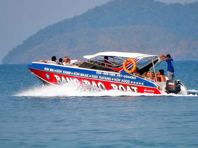
The East Coast. A good road, and quite flat, it runs through farmland, orchards and passes just a few resorts, the public hospital, the police station and the Amphoe building (town hall). Look out for the turn to the right for Than Mayom Waterfall, near that pier.  This waterfall was visited by Thai kings in the past, and their initials are marked on rocks nearby. Than Mayom is as good as Klong Plu waterfall. Heading south on the main road, there's a turn to the left that leads to Salak-kok fishing village, and mangrove forest. Well worth a visit for seafood and a boat trip in the mangrove rimmed bay. A turn to the right, following the sign for Tree House brings you to Long Beach. Caution, the road is muddy, and slippery in the wet season, but the beach is well worth seeing if you do make it. Following the main road on, you come to Salak-Phet fishing village and marina. Boat trips, and sailing charters can be taken from here, and there's a good seafood restaurant on the waterside here too. Whilst down here at the "other end of the island", there's Khiri Phet and Klong Nung waterfalls to see. Unfortunately, the road does not link up the South East with the South West of the island, so we need to retrace our path.
The West Coast. Turning right off the ferry, the road quickly rises and takes hairpin bends. To the right you can see Koh Chang Noi, the small island off the North of Koh Chang. Close by is the Siam Royal View condominium complex on it's man made beach. At the top of the hill, on the raod, there's a Chinese Buddhist temple. Down the hill takes you into Klong Son which is one of the administrative centers of the island. You can take a left turn here into the Klong Son valley. There's the Baan Kwan Chang elephant camp up here, and a good waterfall and trekking route too, right at the end of the valley road. There's another Buddhist temple (or wat) at Klong Son - turn right at the same intersection. After Klong Son, the road again twists and turns and climbs, then falls into Whitesands Beach, which is the main tourist stretch on the island. Large and small resorts are here, cheap and expensive. The Whitesands "metropolitan area" runs for about 3 km along the west coast of Koh Chang.  It's a lovely beach, quite busy though in the high season, but quieter at the north and south ends. After Whitesands the road is quite level, and there are a few resorts and bars dotted along the way. The Koh Chang Post Office is the place to turn right for Pearl Beach which has a few quiet resorts and restaurants, and has the best spot on Koh Chang for snorkeling. Beyond here is Chai Chet, where we live. The best supermarket on the island, V-Mart, is here, as is the busy Moya Pharmacy, and there are a few bars and restaurants in the 2 plazas in Chai Chet (named VJ Plaza and the (imaginatively named) Koh Chang Plaza. Turn right at the Coconut Beach Resort, then you will come to Klong Prao Beach, at the Chai Chet end. The beach stretches for around 6 km, but is divided by the tidal river after 2 km. Explore the rocks at Chai Chet, particularly at sunset. Heading South through the area of Klong Prao on the main road, there's a number of large "package tour" style resorts. Follow the sign for Klong Plu Waterfall, and that's where you will end up. Probably the best waterfall on the island, it's also the most popular so it can be busy. After parking your motorcyle or car, or taxi, the walk is only 400 meters or so, but can be quite slippery. When you arrive at the waterfall, you're sure to enjoy the cool fresh waters of Klong Plu. Afterwards, continue south on the main road passing 2 elephant camps on the left and the Klong Prao temple (wat) on the right. There are a few good local Thai restaurants on this stretch. A couple of bends in the road, and then you will come into Kai Bae which has a smaller and slightly more stoney beach than Klong Prao. Some nice small beach resorts, bars and restaurants, and there's a nice atmosphere in Kai Bae. Leaving the village, the road climbs, and you come to a viewing point, surprisingly known as "View Point". But, it does have the only Tsunami warning siren on Koh Chang. It is worthwhile to stop here before and during sunset to capture some photos. Further on, and following the worst stretch of road, and most dangerous stretch of road, on the island, we come to Lonely beach then Bailan Bay. These are lively back-packing areas, and recently a few boutique style resorts have opened up here. After a few more kilometers we reach the right turn for Bang Bao, the main fishing village and port of the island. Bang Bao has long pier straddled by dive shops, craft shops, bars and restaurants. This is definitely a "must-see", and a place to take a lunch or evening dinner. Just beyond Bang Bao, after passing the Tranquility Bay Condominium complex, there's a nice quiet beach, with a couple of small beach bars. There are great views from here out to the islands to the South of Koh Chang. The road ends a little further on, so you have to retrace your steps once more, back whence you came. Take care on the roads.